![](/images/other/stat-length.png)
![Excursión A pie Weiler bei Bingen - Baumgeister-Tour - Photo](https://media.geolcdn.com/t/1900/400/ext.pjpeg?maxdim=2&url=https%3A%2F%2Fmedia.geolcdn.com%2Ff%2F860edcd6-aac1-44a5-b437-19decf78aa73.jpeg)
Baumgeister-Tour
SityTrail - itinéraires balisés pédestres
Tous les sentiers balisés d’Europe PRO
![Longitud](/images/other/stat-length.png)
Longitud
15,5 km
![Altitud máxima](https://static1.geolcdn.com/siteimages/upload/files/1508320355ic_sort_altitude_max_24dp.png)
Altitud máxima
414 m
![Desnivel positivo](https://static1.geolcdn.com/siteimages/upload/files/1508320355ic_sort_den_pos_24dp.png)
Desnivel positivo
503 m
![Km-Effort](/images/other/stat-length.png)
Km-Effort
22 km
![Altitud mínima](https://static1.geolcdn.com/siteimages/upload/files/1508320355ic_sort_altitude_min_24dp.png)
Altitud mínima
134 m
![Desnivel negativo](https://static1.geolcdn.com/siteimages/upload/files/1508320355ic_sort_den_neg_24dp.png)
Desnivel negativo
528 m
![Boucle](https://static1.geolcdn.com/siteimages/upload/files/16400158638029165_repeat_loop_refresh_sync_direction_icon.png)
Boucle
Sí
Baliza
Fecha de creación :
2022-02-11 16:44:53.83
Última modificación :
2022-02-11 16:44:53.83
![A pie](https://static1.geolcdn.com/sitytour/trail-icons/100.png)
5h04
Dificultad : Medio
![Escanee este código QR para abrir la excursión en la aplicación SityTrail](https://capi.geolives.com/qq0zvz2zws4bq2lad0pu/sitytour/trails/3096777/qr.png?size=200)
Aplicación GPS de excursión GRATIS
A propósito
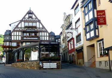
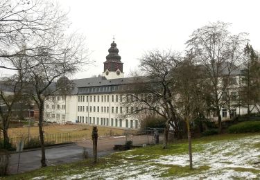
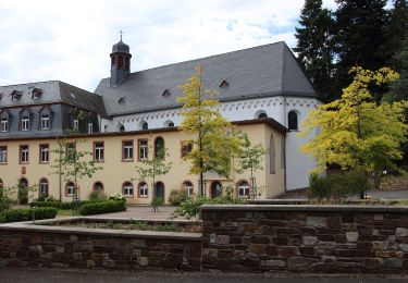
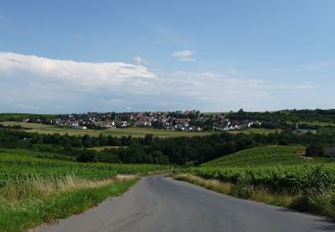
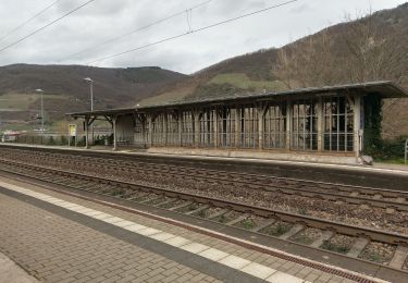
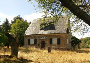
Ruta A pie de 15,5 km a descubrir en Renania-Palatinado, Landkreis Mainz-Bingen, Weiler bei Bingen. Esta ruta ha sido propuesta por SityTrail - itinéraires balisés pédestres.
Descripción
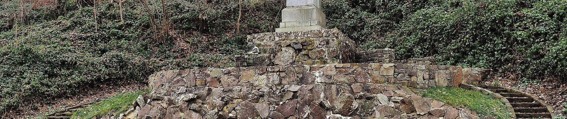
Trail created by Romantischer Rhein Tourismus GmbH.
Symbol: weiße Burgzinnen und stilisiertes R auf rotem Grund (Rheinburgenwegsymbol in rot)
Localización
País:
Germany
Región :
Renania-Palatinado
Departamento/provincia :
Landkreis Mainz-Bingen
Municipio :
Weiler bei Bingen
Localidad:
Unknown
Salida:(Dec)
Salida:(UTM)
418149 ; 5536689 (32U) N.
Comentarios
Excursiones cerca
![Excursión A pie Rüdesheim am Rhein - Rheingauer Klostersteig Zuweg Assmannshausen - Photo](https://media.geolcdn.com/t/375/260/ext.jpg?maxdim=2&url=https%3A%2F%2Fmedia.geolcdn.com%2Ff%2F0b549e65-574a-4424-acfe-276db4f7f1c5.jpeg)
![A pie A pie](https://static1.geolcdn.com/sitytour/trail-icons/100.png)
Rheingauer Klostersteig Zuweg Assmannshausen
A pie
Fácil
Rüdesheim am Rhein,
Hesse,
Rheingau-Taunus-Kreis,
Germany
![](/images/other/stat-length.png)
3,1 km | 4,6 km-effort
1h 3min
![](https://static1.geolcdn.com/siteimages/upload/files/16400158638029165_repeat_loop_refresh_sync_direction_icon.png)
No
![Excursión A pie Rüdesheim am Rhein - Hildegardweg - Photo](https://media.geolcdn.com/t/375/260/ext.jpg?maxdim=2&url=https%3A%2F%2Fmedia.geolcdn.com%2Ff%2F383cc12c-ca7c-4bec-bb31-c2bbae795e1e.jpeg)
![A pie A pie](https://static1.geolcdn.com/sitytour/trail-icons/100.png)
Hildegardweg
A pie
Fácil
Rüdesheim am Rhein,
Hesse,
Rheingau-Taunus-Kreis,
Germany
![](/images/other/stat-length.png)
6,7 km | 9,3 km-effort
2h 6min
![](https://static1.geolcdn.com/siteimages/upload/files/16400158638029165_repeat_loop_refresh_sync_direction_icon.png)
Sí
![Excursión A pie Rüdesheim am Rhein - Rundwanderweg Tanne - Photo](https://media.geolcdn.com/t/375/260/ext.jpg?maxdim=2&url=https%3A%2F%2Fmedia.geolcdn.com%2Ff%2Fb5a53c37-4f34-4e66-bcaa-ee150b2ee425.jpeg)
![A pie A pie](https://static1.geolcdn.com/sitytour/trail-icons/100.png)
Rundwanderweg Tanne
A pie
Fácil
Rüdesheim am Rhein,
Hesse,
Rheingau-Taunus-Kreis,
Germany
![](/images/other/stat-length.png)
3,3 km | 4,1 km-effort
56min
![](https://static1.geolcdn.com/siteimages/upload/files/16400158638029165_repeat_loop_refresh_sync_direction_icon.png)
No
![Excursión A pie Rüdesheim am Rhein - Rundwanderweg Reh - Photo](https://media.geolcdn.com/t/375/260/ext.jpg?maxdim=2&url=https%3A%2F%2Fmedia.geolcdn.com%2Ff%2Fb5a53c37-4f34-4e66-bcaa-ee150b2ee425.jpeg)
![A pie A pie](https://static1.geolcdn.com/sitytour/trail-icons/100.png)
Rundwanderweg Reh
A pie
Fácil
Rüdesheim am Rhein,
Hesse,
Rheingau-Taunus-Kreis,
Germany
![](/images/other/stat-length.png)
3,1 km | 3,8 km-effort
51min
![](https://static1.geolcdn.com/siteimages/upload/files/16400158638029165_repeat_loop_refresh_sync_direction_icon.png)
No
![Excursión A pie Rüdesheim am Rhein - Wanderweg gelber Balken - Photo](https://media.geolcdn.com/t/375/260/ext.jpg?maxdim=2&url=https%3A%2F%2Fmedia.geolcdn.com%2Ff%2F1631cdc5-00bc-479f-8da0-8df5784865c6.jpeg)
![A pie A pie](https://static1.geolcdn.com/sitytour/trail-icons/100.png)
Wanderweg gelber Balken
A pie
Fácil
Rüdesheim am Rhein,
Hesse,
Rheingau-Taunus-Kreis,
Germany
![](/images/other/stat-length.png)
6,2 km | 8 km-effort
1h 49min
![](https://static1.geolcdn.com/siteimages/upload/files/16400158638029165_repeat_loop_refresh_sync_direction_icon.png)
No
![Excursión A pie Waldalgesheim - Rhein-Nahe-Schleife - Photo](https://media.geolcdn.com/t/375/260/ext.jpg?maxdim=2&url=https%3A%2F%2Fmedia.geolcdn.com%2Ff%2Fa9699664-da82-452a-83b2-de6b25b0bfb9.jpeg)
![A pie A pie](https://static1.geolcdn.com/sitytour/trail-icons/100.png)
Rhein-Nahe-Schleife
A pie
Medio
Waldalgesheim,
Renania-Palatinado,
Landkreis Mainz-Bingen,
Germany
![](/images/other/stat-length.png)
20 km | 27 km-effort
6h 1min
![](https://static1.geolcdn.com/siteimages/upload/files/16400158638029165_repeat_loop_refresh_sync_direction_icon.png)
Sí
![Excursión A pie Trechtingshausen - Rheinburgenweg Zugangsweg Trechtingshausen - Photo](https://media.geolcdn.com/t/375/260/ext.jpg?maxdim=2&url=https%3A%2F%2Fmedia.geolcdn.com%2Ff%2F47513b47-8600-4126-93f9-4283300ea9ba.jpeg)
![A pie A pie](https://static1.geolcdn.com/sitytour/trail-icons/100.png)
Rheinburgenweg Zugangsweg Trechtingshausen
A pie
Fácil
Trechtingshausen,
Renania-Palatinado,
Landkreis Mainz-Bingen,
Germany
![](/images/other/stat-length.png)
4,1 km | 8 km-effort
1h 49min
![](https://static1.geolcdn.com/siteimages/upload/files/16400158638029165_repeat_loop_refresh_sync_direction_icon.png)
No
![Excursión A pie Rüdesheim am Rhein - Rundwanderweg Hirschkäfer - Photo](https://media.geolcdn.com/t/375/260/ext.jpg?maxdim=2&url=https%3A%2F%2Fmedia.geolcdn.com%2Ff%2F5506f16b-fe7a-41c9-8250-83e20c4fb2e1.jpeg)
![A pie A pie](https://static1.geolcdn.com/sitytour/trail-icons/100.png)
Rundwanderweg Hirschkäfer
A pie
Fácil
Rüdesheim am Rhein,
Hesse,
Rheingau-Taunus-Kreis,
Germany
![](/images/other/stat-length.png)
5,7 km | 7,5 km-effort
1h 42min
![](https://static1.geolcdn.com/siteimages/upload/files/16400158638029165_repeat_loop_refresh_sync_direction_icon.png)
Sí
![Excursión A pie Rüdesheim am Rhein - Rheinsteig [Rüdesheim - Johannisberg] - Photo](https://media.geolcdn.com/t/375/260/ext.jpg?maxdim=2&url=https%3A%2F%2Fstatic1.geolcdn.com%2Fsiteimages%2Fupload%2Ffiles%2F1545311037marcheuse_200dpi.jpg)
![A pie A pie](https://static1.geolcdn.com/sitytour/trail-icons/100.png)
Rheinsteig [Rüdesheim - Johannisberg]
A pie
Fácil
Rüdesheim am Rhein,
Hesse,
Rheingau-Taunus-Kreis,
Germany
![](/images/other/stat-length.png)
14,8 km | 20 km-effort
4h 32min
![](https://static1.geolcdn.com/siteimages/upload/files/16400158638029165_repeat_loop_refresh_sync_direction_icon.png)
No